Subdivision layout and design
Deed Checking Utility
Join our Newsletter
HomeProducts Downloads Support Ordering Contact Us View Cart
Demo Video
Prices
Run on a Mac

Introduction


Design Tools


Google Earth


Drawing Tools


Deed-Writer


Training Videos


Network version


Requirements

Insert images into the drawing

Previous | Next


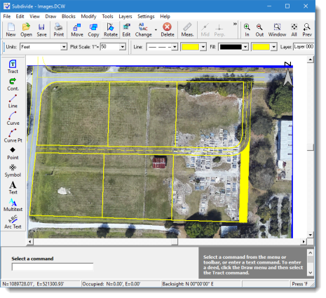
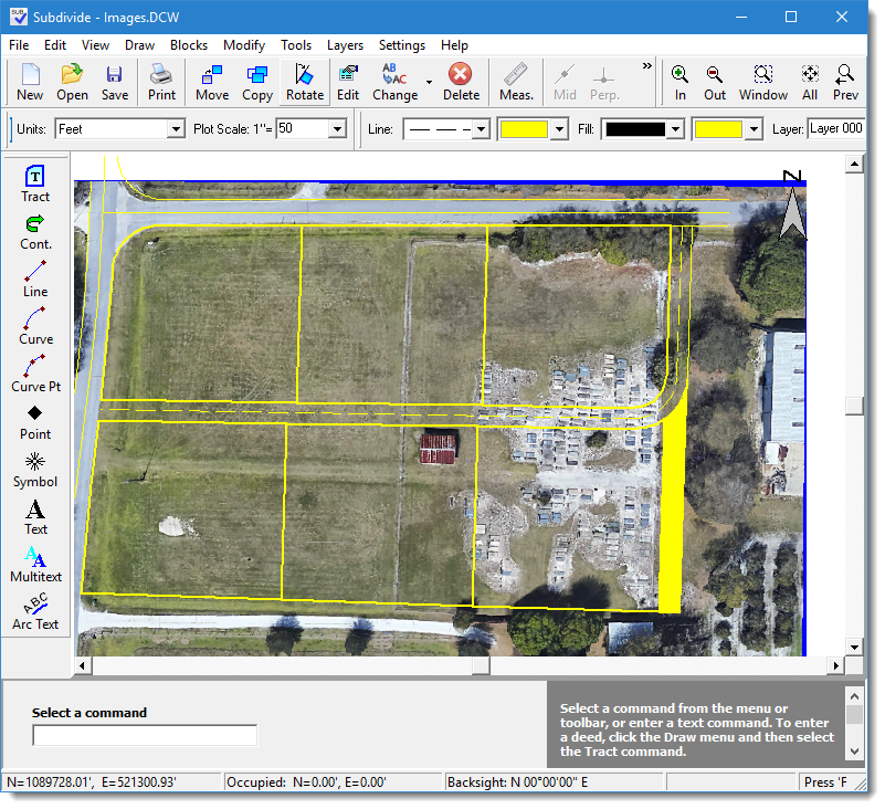
Insert images such as aerials or scanned maps. Use them to trace TOPO features or for a location map. For instance you could use them to trace a pond, or see how your subdivision layout fits the actual ground.


Insert an image

Click for larger image


Previous | Next


Call Sales: 770-509-3661
Have a question? Neet more information? Click here to contact our sales department.

© Copyright 2023, AGT, Inc. All rights reserved.